Thinking about Danville and wondering which neighborhood fits your commute and weekend routine? You are not alone. Between I‑680 access, BART connections, parks, and dining, small location differences can shape your daily life. This guide walks you through Danville’s main areas, commute options, outdoor access, and a buyer checklist so you can choose with confidence. Let’s dive in.
How Danville is organized
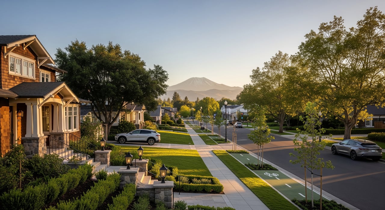
Downtown Village
The historic Village is compact and very walkable. You can stroll to restaurants, cafés, boutiques, community events, and the weekly farmers market. Municipal services and community spaces sit close by, creating a small‑town main street experience.
For commuting, most blocks are a short local drive to I‑680. Exact time depends on your street and traffic patterns, but many buyers choose this area to keep trips simple and quick.
If you value leaving the car at home, the Village places dining, shops, and parks within easy reach. Hap Magee Ranch Park is a nearby green space many residents enjoy. To explore town parks and programs, start with the Town of Danville’s site for Parks and Community Services at the Town of Danville.
West Danville corridor
Along Danville Boulevard and Camino Ramon, you will find flatter, more car‑oriented neighborhoods and larger retail centers. Everyday errands tend to be convenient here, with grocery, pharmacy, and gyms in quick reach.
Freeway access is the big draw. You get direct routes to I‑680 and cross streets that feed south toward San Ramon and north toward Walnut Creek. Many commuters pick this corridor for shorter on‑ramp times.
Parks and schools are dotted throughout the area. If your weekday rhythm includes frequent freeway trips, this corridor often delivers the most efficient drives.
Sycamore and Tassajara
Southeast and southern Danville feature suburban neighborhoods with a mix of single‑family homes, townhomes, and newer subdivisions. Lot sizes vary by street, and some pockets offer more yard space.
From many streets here, you will have a slightly longer local drive to I‑680 than West Danville. It is still a common choice for buyers who want more suburban space and proximity to multi‑use paths and green corridors.
Local parks, community pools, and schools are part of the appeal. If you like quiet streets and easy access to neighborhood trails, this area is worth a close look.
Diablo foothills north
The northern edge of town rises into the foothills of Mount Diablo. It feels more rural‑residential, with curvier streets, larger lots in places, and an emphasis on open space.
Commutes from the foothills can take longer and vary more because local roads are narrower and graded. That said, you are close to some of the East Bay’s best trails and views.
Outdoor lovers appreciate quick reach to the state park and ridge lines. If immediate trail access is a priority, these hill neighborhoods offer compelling options.
Blackhawk and Alamo adjacent
East and northeast of Danville sit unincorporated Contra Costa County communities, including Blackhawk and parts of Alamo. These areas are distinct from the Town of Danville in governance and services.
Neighborhoods here include higher‑amenity, gated or semi‑gated subdivisions and country‑club communities. You can access I‑680 from multiple directions, which can be efficient for both northbound and southbound commuters.
Residents use Blackhawk Plaza for shopping and dining, and many enjoy private club and golf options. If resort‑style amenities or gated features matter to you, these communities deserve consideration.
Commute basics on I‑680
I‑680 is the main north‑south artery for Danville and the interior East Bay. Most commuters take local streets to an I‑680 on‑ramp, then head north toward Walnut Creek and Contra Costa employment centers or connect to regional routes serving San Francisco and the broader Bay Area. Southbound travelers connect toward the Tri‑Valley and Silicon Valley.
Traffic is time sensitive. Peak hours in the morning and late afternoon often slow down. For current conditions, travel times, and lane closure alerts, check Bay Area 511 before you head out.
Carpool and express lanes change over time. If you plan to use HOV or express lanes, confirm current configurations and rules through 511’s resources to keep your options flexible.
Transit options near Danville
Danville does not have a BART station within town limits. The nearest stations commonly used by residents include Walnut Creek and Pleasant Hill to the northwest, and Dublin/Pleasanton to the southeast. You can review station details and parking policies on the BART stations page.
For bus connections, County Connection links Danville with nearby BART stations and other Contra Costa destinations. Check route maps and timetables on County Connection to plan an integrated commute.
Many residents combine a short drive with park‑and‑ride. If you plan to park at BART, confirm availability and rules for your preferred station, and test the routine at your typical commute times.
Parks and trails you will use
Outdoor access is a signature Danville advantage. To the east, expansive recreation sits within reach at Mount Diablo State Park. To the north and northeast, the Las Trampas Regional Wilderness delivers ridge hikes, bike routes, and sweeping views.
Neighborhoods in the Diablo foothills have some of the most immediate trail access, while other areas are a short drive to trailheads and multi‑use paths. Within town, community parks, fields, and centers host youth sports, swimming, and classes. You can review local facilities and programs through the Town of Danville.
If trails are a top priority, visit a few trailheads on weekends to gauge parking, crowds, and the difficulty level that fits your routine.
Dining and daily conveniences
- Village core: Walkable restaurants, cafés, boutiques, and a farmers market vibe support an easy, park‑once lifestyle.
- West Danville: Big‑box and everyday retail along Danville Boulevard and nearby corridors simplify errands.
- Blackhawk Plaza: Shopping and dining cluster that serves eastern neighborhoods and nearby unincorporated communities.
Choose the vibe that best fits your week. If you prefer walking to dinner, focus near the Village. If faster freeway access and larger shopping centers rank higher, the western corridor often works well.
How to test your commute
Before you commit to a neighborhood, verify the day‑to‑day experience.
- Drive your exact route to and from work on a weekday during your actual AM and PM windows.
- Check live conditions and incident alerts on Bay Area 511 and note variability by day.
- If using transit, confirm County Connection bus times and your preferred BART station parking routine.
- Try a backup method, such as carpooling or a different station, to see if it changes your neighborhood options.
Buyer checklist: narrow your shortlist
Use these focused questions and actions to align your choice with your routine.
Commute and transportation
- Where is your employer located, and which direction is your peak commute?
- Is being within 5 to 10 minutes of I‑680 a priority, or can you accept a longer local drive?
- Will you rely on transit to reach BART, or will you drive and park at a station?
- Action: Drive the exact commute at peak times and record your times for a full week.
Daily lifestyle and dining
- Do you want to walk to restaurants and a farmers market, or are you comfortable driving for meals and errands?
- Which grocery, pharmacy, and fitness options do you want within a short drive?
- Action: Visit the Village and Blackhawk Plaza during meal hours and a weekend to observe crowds and parking.
Outdoor access and recreation
- Do you want immediate trail access or is a short drive acceptable?
- Do you prefer flat streets and yards or are you comfortable with hill grades?
- Action: Tour trailheads at Mount Diablo State Park and Las Trampas to gauge parking and difficulty.
Home and lot preferences
- What lot size and yard use do you need, such as a garden, pool, or play area?
- Are you comfortable with HOA rules and gated community governance, or do you prefer non‑HOA neighborhoods?
- Action: Ask the listing agent about HOA fees, CC&Rs, maintenance responsibilities, and parking rules.
Schools and services
- Most Danville neighborhoods are served by the San Ramon Valley Unified School District. Confirm the exact school assignments for any address.
- Consider proximity to healthcare, urgent care, and routine services.
- Action: Use SRVUSD to review boundary maps and school websites for current information.
Safety and long‑term factors
- If you are considering foothill properties, review wildfire risk and defensible‑space requirements.
- Check for floodplain considerations in lower‑lying areas and any planned road or development projects.
- Action: Review wildfire resources from CAL FIRE and the Contra Costa County Fire Protection District before finalizing a choice.
Verify with local resources
- Town parks and programs: Town of Danville
- Traffic and transit planning: Bay Area 511
- Regional rail stations and parking: BART stations
- Local bus routes and timetables: County Connection
- Regional wilderness and trails: Las Trampas Regional Wilderness
- State park trails and info: Mount Diablo State Park
- School boundaries and contacts: SRVUSD
- Wildfire preparedness and maps: CAL FIRE and Contra Costa County Fire Protection District
Ready to match your neighborhood to your commute, parks, and daily routine? With 30 years of local guidance, the Rita Dhillon Team can help you test routes, compare micro‑areas, and move forward with confidence.
FAQs
Which Danville areas offer the quickest I‑680 access?
- Neighborhoods along the West Danville corridor near Danville Boulevard and Camino Ramon typically provide the most direct routes to I‑680.
What are the nearest BART stations to Danville for commuters?
- Common choices are Walnut Creek and Pleasant Hill to the northwest and Dublin/Pleasanton to the southeast, depending on your destination and parking needs.
Where can I find reliable trail access near Danville?
- Mount Diablo State Park and Las Trampas Regional Wilderness offer extensive networks, with foothill neighborhoods providing the most immediate access.
How do Blackhawk and Alamo areas differ from Danville governance?
- They are unincorporated Contra Costa County, not within the Town of Danville, so services and community governance can differ from Danville proper.
How can I confirm which schools serve a specific Danville address?
- Use SRVUSD resources to review attendance boundary maps and verify school assignments for the exact property address.